
Why Cloud Aerial Photogrammetry Will Become Essential for RTK Drone Operators in 2026
- Antonio Liska

- Dec 9, 2025
- 6 min read

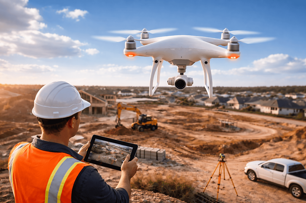
Imagine flying a large site, uploading the images from the field, and having processed outputs ready before the end of the day without taxing your workstation. This is not science fiction. It is the direction the drone mapping industry is moving as 2025 ends and 2026 begins.
RTK drones now deliver high-precision geospatial data with remarkable consistency. But while field acquisition has become faster and more accurate, one challenge continues to slow teams down: turning raw images into usable maps at scale.
In 2026, operators who adopt cloud-based photogrammetry will gain a measurable advantage. Cloud processing replaces local hardware limitations with elastic compute power, automated workflows, and the ability to handle increasingly large datasets generated by modern RTK drones. Accuracy still comes from strong RTK corrections in the field. Speed, scalability, and operational efficiency come from the cloud.
Together, they form the new end-to-end workflow for surveyors, engineers, mining teams, and GIS professionals.
What Cloud Aerial Photogrammetry Actually Means
Cloud aerial photogrammetry is the practice of uploading drone imagery to aerial photogrammetry software hosted in the cloud, where orthomosaic generation, point cloud creation, 3D modeling, and volumetric analysis occur on high-performance servers rather than a local workstation.
These platforms reliably produce:
• orthomosaics
• digital surface models
• digital terrain models
• classified point clouds
• contours
• volume and cut-fill reports
• 3D textured models
The important distinction is not that cloud processing changes how photogrammetry works. It changes where and how efficiently it runs. A cloud system:
• processes projects without overloading local machines
• scales compute power based on dataset size
• handles multiple missions simultaneously
• maintains consistent processing pipelines across teams
This consistency is especially valuable for RTK workflows, where centimeter-level inputs benefit from standardized, well-tuned reconstruction algorithms.
Why RTK Drone Operators Face New Processing Demands in 2026
Across surveying, civil engineering, mining, utilities, and public safety, aerial data capture is increasing quickly. More flights, larger areas, and higher accuracy expectations put pressure on both acquisition and processing teams.
Modern RTK drones can capture hundreds of acres per mission with high precision. The bottleneck is no longer collecting data. The bottleneck is processing high-resolution imagery into deliverables quickly and consistently.
Typical challenges include:
• long local processing times for large point clouds
• hardware limitations on RAM, GPU, and thermal performance
• inconsistent results from manual workflows
• difficulty processing multiple missions simultaneously
• complexity of storing and transferring massive datasets
Cloud platforms are being adopted to solve these issues because they offer stable processing environments, predictable output quality, and the ability to scale workflows across teams and departments.
Why Cloud Photogrammetry Is Growing Rapidly Heading Into 2026
Several trends are accelerating the shift toward cloud-based workflows
1. Local Workstations Struggle with Modern Datasets
High-resolution cameras, larger sensors, and higher overlap missions have pushed dataset sizes well beyond what many laptops or even desktops comfortably handle.
Tasks such as:
• dense point cloud reconstruction
• orthomosaic stitching
• terrain modeling
• volumetric analysis
can take hours locally and are sensitive to hardware constraints. Cloud systems scale compute resources automatically, reducing delays and improving predictability. This does not guarantee instant results, but it consistently shortens processing time compared to local hardware for medium and large projects.
2. Drone Programs Are Expanding Inside Organizations
Organizations that once flew drones occasionally now capture data for multiple use cases, including construction monitoring, stockpile volumes, infrastructure inspections, and emergency scene documentation.
Cloud platforms support this expansion through:
• centralized data management
• standardized processing settings
• consistent deliverables across departments
• long-term archival for compliance and audits
• shared access without transferring large files manually
The shift from single-department to multi-department drone use is one of the strongest drivers of cloud adoption.
3. Larger Sensors and Higher Resolution Payloads Increase Data Volume
New drone cameras continue to push beyond previous resolution limits. These advancements produce more detailed outputs but also heavier datasets that:
• demand more processing power
• increase memory and storage requirements
• result in longer reconstruction times on local machines
Cloud platforms absorb this growth more effectively because their compute resources scale horizontally.
4. Clients Expect Faster Turnaround Times
Construction teams increasingly expect same-day orthomosaics for progress updates. Mining operations want updated volumes for daily or weekly reconciliation. Public safety teams may need rapid 3D reconstructions for decision making.
Cloud processing helps meet these expectations by enabling:
• fast uploads from the field or office
• parallel processing of multiple flights
• predictable delivery times, even for large areas
While not all datasets process in minutes, cloud workflows reliably shorten delivery cycles compared to desktop systems.
5. AI-Assisted Photogrammetry Is Becoming More Common
AI and machine learning are expanding into photogrammetry tasks such as:
• point cloud classification
• vegetation filtering
• automated object detection
• seamline optimization
• GCP identification
• terrain feature extraction
These tools require significant computational power. Cloud platforms are better suited than local machines to support these workloads and update algorithms continuously.
Benefits of Cloud Aerial Photogrammetry for RTK Drone Professionals
The operational advantages of cloud workflows are becoming clearer each year.
1. Faster and More Predictable Turnaround Times
Cloud systems reduce waiting periods and allow teams to work on multiple datasets at once. This increases productivity and helps deliver data to clients faster, improving project efficiency and output volume.
2. No More Hardware Constraints or Frequent Upgrades
Cloud photogrammetry reduces reliance on powerful local hardware. Operators can process large datasets from lightweight laptops or office computers, with the heavy computation handled remotely.
This improves mobility and lowers long-term equipment costs.
3. Consistent, Standardized Processing Pipelines
For RTK workflows, consistency matters as much as accuracy. Cloud platforms maintain stable algorithms, reducing variations caused by local settings or mismatched software versions. This benefits:
• time-series analysis
• cut-fill comparisons
• long corridor mapping
• multi-season or multi-project reporting
The accuracy still depends on flight quality, RTK correction stability, and when required properly placed GCPs or checkpoints.
4. Easier Collaboration and File Management
Drone imagery and point clouds are large and difficult to share manually. Cloud-based systems provide:
• browser-based review
• shared access for internal and external teams
• version control
• centralized storage with metadata
• reduced IT overhead
This removes friction from team collaboration.
5. More Efficient and Scalable Cost Structure
Instead of investing in high-end workstations and frequent upgrades, teams shift to a subscription model that scales with project volume. Cloud platforms often reduce manual labor time as well, making the overall cost of ownership more predictable.
How Cloud Photogrammetry Complements RTK Equipment Like RoboDot Touch
RTK and cloud processing are not substitutes. They are complementary parts of a modern workflow.
Systems like RoboDot Touch RTK Base/Rover strengthen cloud photogrammetry results by:
• delivering consistent, reliable RTK corrections
• improving absolute horizontal and vertical accuracy
• reducing dependence on heavy GCP workflows for many projects
• supporting repeatable missions where alignment between datasets matters
• enabling accurate mapping even in remote or challenging environments
Cloud processing then converts this precise input data into deliverables efficiently and consistently.
Together, they create a streamlined field-to-finish pipeline suitable for demanding applications in surveying, mining, engineering, agriculture, and public safety.
The Future of Drone Mapping in 2026 and Beyond
The industry is moving toward scalable, automated, cloud-supported workflows because they offer:
• predictable processing times
• multi-team collaboration
• AI-enhanced data classification
• structured, repeatable outputs
• elastic compute power for large datasets
RTK accuracy in the field, paired with cloud automation in the office, is becoming the standard approach for delivering high-quality geospatial products at scale.
Teams adopting these workflows will work faster, handle larger workloads, and deliver more consistent results.
Ready to Deliver Faster, More Accurate Aerial Data in 2026? Robota Can Help
If your work depends on precise, reliable drone data, upgrading your workflow is the next step. Robota builds professional-grade RTK solutions, fixed-wing drones, and automation platforms designed for accurate mapping, simplified deployment, and efficient field operations.
Whether you are a surveyor capturing high-accuracy topographic data, a mining team measuring stockpiles, a civil engineering group documenting progress, an agricultural operator monitoring fields, or a public safety team mapping critical scenes, Robota provides dependable tools that fit your mission.
Enhance your data accuracy. Reduce workflow bottlenecks. Move from field to finished deliverables faster.
Explore the RoboDot Touch RTK Base/Rover, Eclipse 2.0 Fixed-Wing Drone, and Goose Autopilot at Robota.us and see how the next era of cloud-enabled RTK mapping begins.


Comments