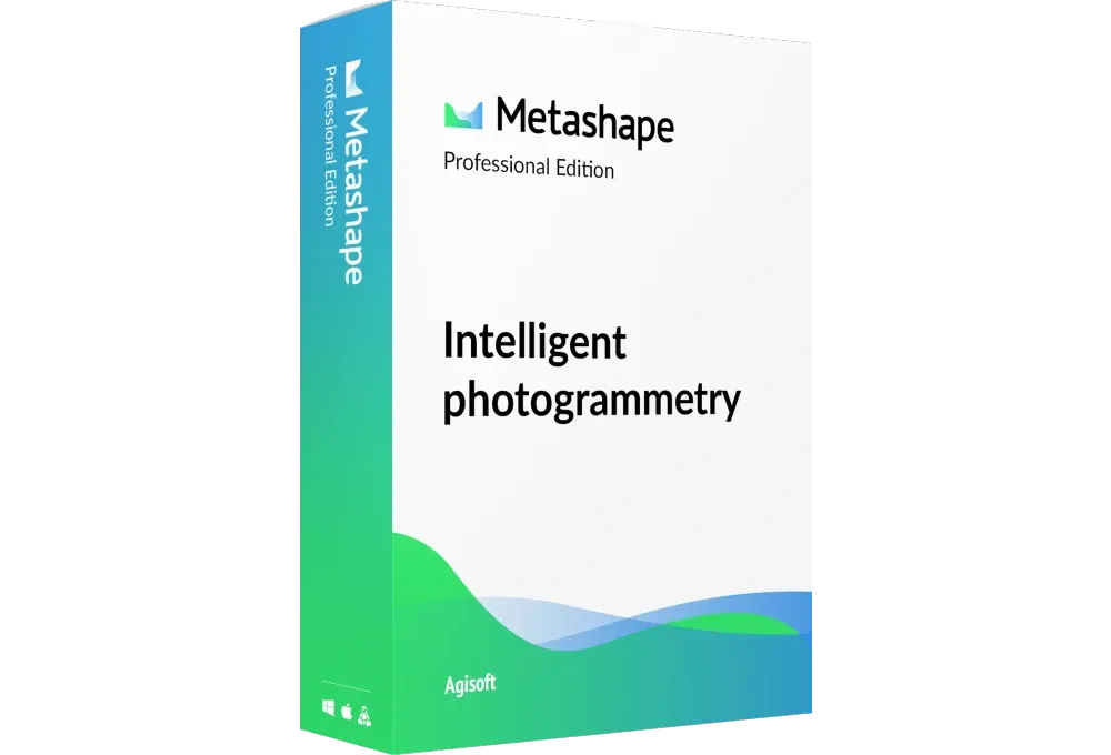
Metashape Pro: Professional
$3,499
Perpetual node-locked professional license with the full feature set: dense point clouds, DEMs, orthomosaics, Python scripting, batch and network processing.
Professional License
Photogrammetry Software
Professional photogrammetric processing that turns drone imagery into accurate 3D models, orthomosaics, and GIS-ready datasets. Licensed through Robota, an authorized reseller.
What It Does
Agisoft Metashape is a stand-alone software product that performs photogrammetric processing of digital images and generates 3D spatial data. Its engine drives photogrammetry to its limits while machine-learning techniques handle post-processing and analysis tasks.
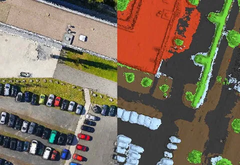
Process images from RGB or multispectral cameras, including multi-camera systems, into dense point clouds, textured polygonal models, georeferenced true orthomosaics, and DSMs/DTMs. Post-processing can remove shadows and texture artifacts, calculate vegetation indices, produce action maps for farming equipment, and automatically classify dense point clouds.
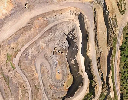
Whether you capture with fixed-wing UAVs, multirotor drones, or custom platforms, Metashape handles aerial mapping at scale, from mining sites to agricultural fields, with accurate 3D reconstruction for any terrain.
The Robota Workflow
Metashape Pro becomes a complete drone mapping solution when combined with our RTK GNSS receivers. Use RoboDot Touch as your base station or smart ground control point, mark GCPs with the RoboDot GCP stencil, and feed centimeter-accurate coordinates straight into your Metashape project.
The result: high-accuracy 3D models and GIS-ready datasets for industries from agriculture to infrastructure planning, with fewer field revisits and predictable, repeatable accuracy. And because we run these workflows ourselves, our support goes beyond license delivery: we help you get to a defensible deliverable.
Metashape is optimized for multi-core CPUs and multi-GPU systems, with distributed processing on HPC clusters for massive datasets, making it one of the most scalable photogrammetry solutions available for high-resolution imagery, LiDAR fusion, or multispectral analysis.
Outputs
GeoTiff (.tif), .kml
.las, .laz, .ply, .xyz
GeoTiff (.tif), .xyz, .las, .laz
.ply, .fbx, .dxf, .obj, .pdf
GeoTiff (.tif), .shp
.dxf, .dwg, .shp
Licensing
$3,499
Perpetual node-locked professional license with the full feature set: dense point clouds, DEMs, orthomosaics, Python scripting, batch and network processing.
Professional License$599
The same professional feature set, licensed for degree-granting institutions, faculty, and students. Proof of academic affiliation required.
EDU LicenseNeed a quote for multiple seats, a floating license, or purchasing questions? Use the form below and we will send a purchase link the same business day.
FAQ
Agisoft Metashape Pro is a professional photogrammetry software used to process digital images and generate high-quality 3D spatial data. It transforms images from drones, cameras, or multi-camera systems into dense point clouds, textured 3D models, orthomosaics, and digital surface models (DSMs) or digital terrain models (DTMs), making it ideal for aerial mapping solutions in various industries.
Agisoft Metashape Pro offers advanced features including automated image processing, support for RGB and multispectral cameras, and generation of dense point clouds, textured polygonal models, and georeferenced orthomosaics. It supports multi-core CPUs and GPUs for fast processing, offline operation, and distributed processing for large datasets. Additional capabilities include shadow and texture artifact removal, vegetation index calculation, and compatibility with drone mapping and photogrammetry solutions.
Yes, Agisoft Metashape Pro is highly effective for large site mapping. It is optimized for processing massive datasets using multi-core CPUs, multi-GPU systems, and distributed processing on high-performance computing clusters, enabling fast and accurate generation of 3D models and orthomosaics for extensive areas, making it a top choice for drone mapping and photogrammetry software.
Drone photogrammetry with Agisoft Metashape Pro achieves high accuracy, often reaching up to 3 cm for aerial imagery and 1 mm for close-range photography. The software’s precise image alignment and integration with RTK/PPK workflows ensure reliable results for professional mapping and surveying applications using UAS photogrammetry software.
Not all drones are suitable for photogrammetry. Drones used for photogrammetric surveys typically need a stable flight platform, a quality camera, and precise GPS functionality to ensure accurate and reliable data. Agisoft Metashape Pro supports imagery from a wide range of drones, as long as they capture overlapping images with sufficient clarity and consistency. This makes the software versatile and compatible with many UAV platforms for aerial mapping solutions.
Photogrammetry with Agisoft Metashape Pro requires a drone or camera (RGB or multispectral, 5+ megapixels), a computer with a multi-core CPU, sufficient RAM (32+ GB recommended), and a high-end GPU for faster processing. Optional equipment includes RTK/PPK-enabled drones or ground control points (GCPs) for enhanced accuracy in drone mapping and photogrammetry solutions.
Photogrammetry is used to create detailed 3D models, maps, and spatial data from images. Applications include topographic mapping, cultural heritage documentation, visual effects production, and precise measurements for surveying, construction, agriculture, and archaeology, leveraging drone mapping and photogrammetry software like Agisoft Metashape Pro.
Agisoft Metashape Pro is used in industries such as surveying, agriculture, archaeology, cultural heritage preservation, mining, construction, and visual effects. Its ability to generate accurate 3D models and orthomosaics makes it valuable for professionals utilizing UAS photogrammetry software for mapping and analysis.
Aerial mapping is used to create detailed maps, orthomosaics, and 3D models of landscapes or sites. It supports land surveying, urban planning, environmental monitoring, agriculture management, and infrastructure development by providing accurate geospatial data through aerial mapping solutions like Agisoft Metashape Pro.
Agisoft Metashape Pro is widely regarded as the best photogrammetry software for drones due to its advanced automation, support for various camera types, and high accuracy in generating 3D models and orthomosaics. Its optimization for large datasets and integration with RTK/PPK workflows make it ideal for drone mapping and photogrammetry solutions.
Agisoft Metashape Pro stands out as the best aerial mapping software, offering robust tools for processing aerial imagery into precise 3D models, orthomosaics, and DSMs/DTMs. Its compatibility with multi-core CPUs, GPUs, and distributed processing ensures efficient handling of large-scale projects, making it a leading choice for aerial mapping solutions.
Tell us which license you need and we will reply with a secure purchase link, delivery timeline, and activation instructions.