
RTK GNSS
RTK GPS Receivers, Without the Survey-Department Price
An RTK GPS receiver corrects ordinary satellite positioning down to the centimeter — the difference between "somewhere on this parcel" and "this stake, right here." Robota has been building them since the original RoboDot: multi-band receivers that a drone crew, surveyor, or GIS team can run without a support contract.
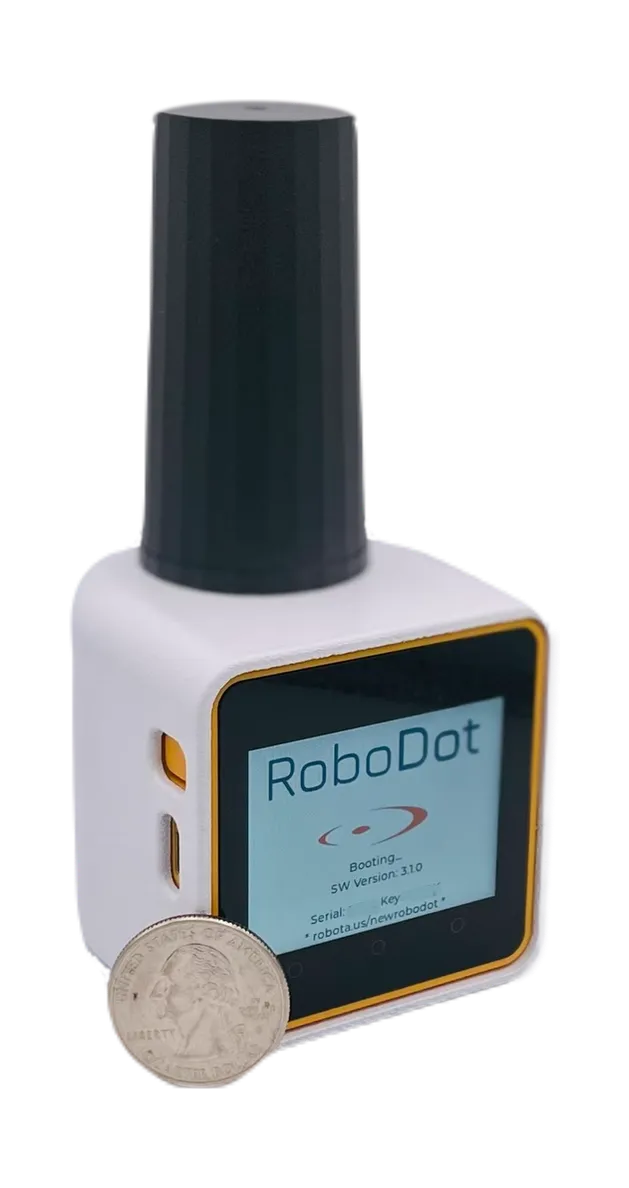
The Receiver
RoboDot Touch: Four Receivers in One
Most crews need a base one day, a rover the next, and a static logger for OPUS the day after. RoboDot Touch is all of them — base station, rover, logger, and repeater — switched from its touch screen, no laptop required.
- Multi-band, multi-constellation: GPS, GLONASS, Galileo, BeiDou on L1/L2/E1/E5b/B1I
- NTRIP built in, both directions: serve corrections as a base or consume them as a rover
- Bluetooth LE position output — pairs with GNSS Master and standard GIS apps
- 10+ hour battery, touch screen plus browser interface, 340 g on a standard 1/4-20 mount
- Logs raw observations for RINEX conversion, OPUS, and PPK workflows
Every capability above is documented, not promised — the full user guide lives at docs.robota.us.
Fit
Which setup fits your work?
Drone mapping
Run RoboDot Touch as your base with NTRIP to the drone's controller, and mark checkpoints with the GCP stencil. Process in Metashape Pro.
Surveying & stakeout
Rover mode with RoboNet VRS corrections — 1–2 cm without owning a base — or run your own RTK base station on site.
GIS data collection
Bluetooth the position stream to GNSS Master or your collection app of choice; the 6 cm 100H GIS plan covers mapping-grade work at $14.99/month.
Learn
RTK guides from our field notes
What is an RTK GPS receiver?
How RTK turns meter-level GPS into centimeter-level positioning.
RTK GPS for surveying
Everything beginners need to know before the first stakeout.
Choosing a GNSS receiver for drone mapping
What actually matters when the receiver rides on a drone project.
GNSS vs GPS
The difference, and why multi-constellation wins in the field.